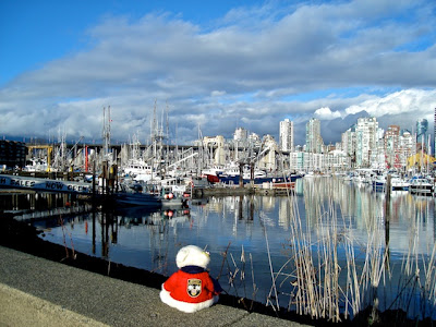
On Canada's Pacific coast, where a huge river named the Fraser dumps
its silty water into the Strait of Georgia, you'll find a beautiful port city: Vancouver, British Columbia.
Vancouver wraps around the coastline from the banks of the Fraser
River, around English Bay and False Creek, into Coal Harbour and Burrard Inlet.
Over 600,000 people call the city home.
An amazing 22 kilometres of Vancouver's coastline is a seawall.
A seawall, like a dike, can be a really useful thing, preventing
floods and erosion. It can also form a really neat path to walk, jog, bicycle,
rollerblade, or skateboard along the shoreline.
The construction of Vancouver’s seawall began around Stanley Park way back in 1917. A master
stonemason named James Cunningham worked on the project for about 35 years!
The 8.8-kilometre-long stretch of seawall around Stanley Park was
officially finished in 1980. Since then, Vancouver’s seawall has been slowly extended all the way south to a neighbourhood called Kitsilano.
Over my next few posts, I'd like to share some of my walks along the
seawall with you.
Let’s begin today’s leg at the
southwestern end of the seawall, in Kitsilano.
Kitsilano is named after August
Jack Khatsahlano, a leader of the Squamish
people. The Squamish people are part of
the Coast Salish family of
First Nations
cultures.
Kitsilano Point overlooks a beautiful stretch of beach
that’s really busy on warm days. You can look north from Kits Point toward
downtown Vancouver …
and the neighbourhood of high-rise apartments called the
West End …
west to all the freighters anchored in English Bay …
and east toward the Burrard Bridge, one of three bridges
that cross the inlet called False Creek.
A path leads from Kitsilano Beach eastward to Vanier Park.
The park was named for Georges Vanier, who was once Governor General of Canada (that is, the Queen’s representative in our nation’s capital, Ottawa).
There is some great public art in Vanier Park.
I’m sitting on
a
sculpture called Gate to the Northwest
Passage, by an artist named Alan
Chung Hung. It gives a nice view toward sculptor Jun Ren’s Freezing Water #7.
This is the Vancouver
Maritime Museum at Vanier Park.
It holds the St. Roch,
an RCMP schooner that was the first ship ever to sail all the way around North
America – including the icy, difficult Northwest Passage through the Arctic.
Remember Alan Chung Hung’s sculpture?
The Maritime Museum also has a Heritage Harbour, where historic ships are moored.
This 30.5-metre-tall totem pole is an exact copy of one that
was presented to Queen Elizabeth in 1958 (yup, she’s been our queen for a very
long time). It’s called the Centennial
Pole because it was created to mark British Columbia’s centenary as a British colony, since 1858.
The pole was created by a great Kwakwaka’wakw artist named Mungo Martin. The Kwakwaka’wakw are a group of First Nations who live on northern
Vancouver Island, and on the B.C. mainland across Queen Charlotte and Johnstone
Straits.
The Vancouver Museum
and H.R. MacMillan Space Centre
share a building nearby.
A Coast Salish village once stood in Vanier Park; the
planetarium’s roof is a tribute to a traditional Coast Salish woven hat.
Pretty, eh?
This stainless-steel crab is in fact a fountain over six
metres tall! It was designed by George
Norris, and has been playing in the water here since 1968.
I was delighted to meet a group of students here from Sea
Island Elementary School!
Strolling on past Vanier Park, we walk right underneath the Burrard Bridge. This pretty bridge was
built between 1930 and 1932. Just east of the bridge is a magnificent
Squamish Nation “welcome figure.”
Such carved figures were traditionally set at the entrance
to Coast Salish communities, to show visitors that they were welcome guests.
This welcome figure also seems to welcome fishermen back
from the sea, because it looks out over a big marina full of commercial fishing
boats.
Ambling along the seawall past pretty waterside
condominiums, we come next to Granville
Island. And I’ll tell you more about that in my next post.
Story © S. Clouthier
Coast Salish Hat courtesy Elodie Ramjheetun
Other photos © S. Clouthier and D. Wei


No comments:
Post a Comment